National Weather Service-Lincoln meteorologist Mike Albano joined Galesburg's Morning News to discuss the “slam-dunk” historic storm hitting west-central Illinois this weekend — timeline, two-phase snow, 40 mph winds, and single-digit cold to follow.
Full breakdown:
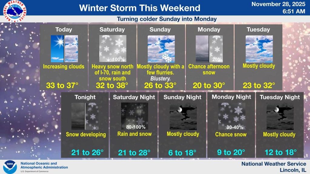
- When it starts: Snow spreads in from Iowa after midnight tonight (Friday night into Saturday morning)
- Worst window: 3 a.m.–noon Saturday — heaviest rates over 1" per hour for several hours
- Snow type: Starts light & fluffy (major blowing/drifting) → turns heavy, wet, and sloppy Saturday afternoon
- Expected totals: 8–14 inches widespread across Galesburg, Knox County, Peoria, Quad Cities, and most of Chicagoland
- Winds: Gusts nearing 40 mph Saturday evening → high risk of downed trees, power lines, and widespread outages
- Travel: NWS is strongly discouraging all travel — roads will be dangerous to impassable Saturday
- After the storm: Canadian cold blast + fresh snow = single-digit lows Sunday night (6–18°) and Monday night (9–20°) with wind chills near 0°
- Early next week: Another quick 1–2" possible late Monday–Tuesday; cold pattern continues into December
- Rarity: Once-every-20-year event for central/southeast Illinois (last comparable storm: weekend after Thanksgiving 2019)
Mike Albano’s bottom line: “Confidence is about as high as it gets — this one’s a slam dunk.” Winter Storm Warnings are in effect.
What you should do TODAY (Friday):
- Charge every device
- Stock food, water, batteries, flashlights
- Fill your gas tank
- Plan to stay home from late tonight through Saturday night
[caption id="attachment_690015" align="aligncenter" width="800"]