
On this episode of Galesburg’s Morning News, meteorologist Chris Geelhart from the National Weather Service Central Illinois Office in Lincoln discusses the expansive arctic blast and winter storm system affecting Galesburg and a large part of the country.
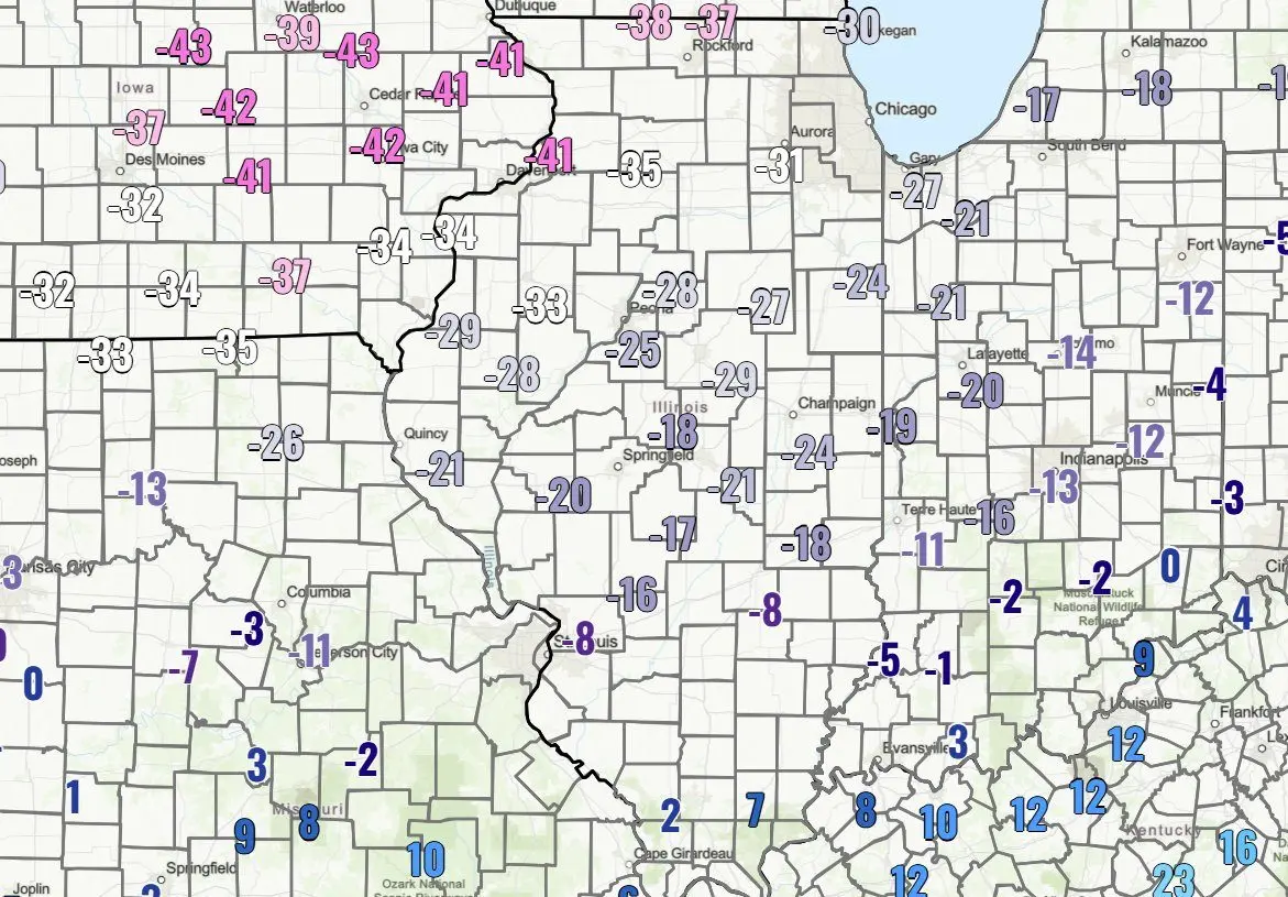
Early Friday morning, temperatures in Galesburg dropped to minus 11 degrees with wind chills reaching minus 34 degrees, prompting most area school districts to close today.
He describes it as one of the biggest systems in recent memory, stretching from the northern plains to New England and as far south as Texas and the Carolinas.
Locally, today and tonight stay dry but bitterly cold, with wind chills dangerously low. Saturday, highs remain in the single digits, and another wave of bitter cold arrives Sunday night into Monday. Snow is expected late Saturday night into Sunday—~2 inches forecast for Galesburg, with up to 4 inches closer to Peoria. The heaviest snow and ice will be south of us, with some areas seeing a foot or more.
Geelhart debunks myths like "too cold to snow"—dry, fluffy snow is possible in extreme cold—and "exploding trees"—cracking can occur, but full explosions are rare. Thundersnow isn't likely in this system.