Galesburg should see its first white Christmas in five years, but the days leading up to the holiday will be filled with extreme cold temperates and blizzard-like conditions.
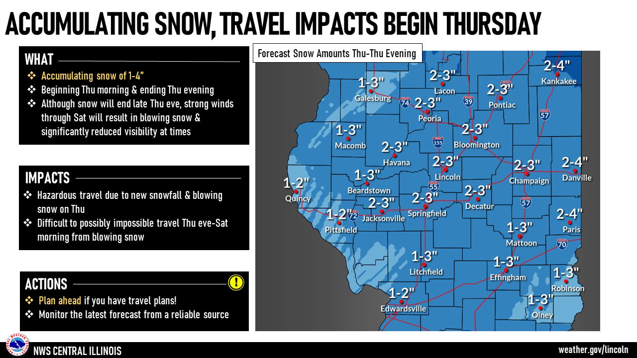
Michael Albano, a meteorologist with the National Weather Service in Lincoln, tells WGIL a powerhouse winter storm that arrives Thursday is so big it will impact central and western Illinois through Saturday morning.
Albano said confidence is “pretty high” that the Galesburg-area will see widespread 1 to 4 inches of snow from Thursday morning before ending Friday morning.
“This is going to pair together with some very strong wind gusts of 35 to 45 miles per hour, followed by some extreme cold,” Albano said. “So all three of those variables paired together can lead to some pretty treacherous travel conditions late week into the early weekend.”
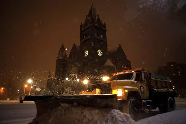
There’s a method to snow and ice removal. Here is Galesburg’s plan once winter arrives
The winds will ramp up about lunch time Thursday, and west central Illinois will see its strongest winds early Friday morning. The heaviest snow will make its way through the area about mid-afternoon Thursday.
The Thursday commute could see some blizzard like conditions, according to Albano.
“Even though we’re not predicting 6 to 10 inches of snow, we do think the blowing snow could impact travel on area roadways into Saturday,” he said. “The snow shuts off by Friday morning, but it’s going to be the winds that stick around that will cause blowing and drifting snow.”
The forecast for the Galesburg-area
Snow. Patchy blowing snow after noon. Temperature falling to around 0 by 5pm. Wind chill values between -13 and -23. Blustery, with a northwest wind 8 to 13 mph increasing to 18 to 23 mph in the afternoon. Winds could gust as high as 38 mph. Chance of precipitation is 90%. New snow accumulation of 2 to 4 inches possible.
Thursday night
Widespread blowing snow, mainly after midnight. Mostly cloudy, with a low around -9. Wind chill values between -26 and -34. Blustery, with a west northwest wind 23 to 25 mph, with gusts as high as 45 mph.
Friday
Widespread blowing snow. Partly sunny and cold, with a high near 1. Blustery, with a west northwest wind 26 to 29 mph, with gusts as high as 48 mph.
Friday night
Areas of blowing snow. Mostly cloudy, with a low around -5. Blustery, with a west northwest wind 20 to 28 mph, with gusts as high as 48 mph.
Saturday
Areas of blowing snow. Sunny and cold, with a high near 7. Blustery, with a west northwest wind 16 to 20 mph, with gusts as high as 33 mph.
Saturday night
Partly cloudy, with a low around -5.
Christmas Day
Mostly sunny, with a high near 18.
Temperatures will remain below freezing until a warming trend arrives early to mid next week.
How often does Galesburg have a white Christmas?
Statistically, Galesburg fails to have a white Christmas more often than not, according to Albano. He said Galesburg has snow on the ground on Dec. 25 about 20 to 25% of the time.
The last time Galesburg had a white Christmas was five years ago. Since 2010, Galesburg has a white Christmas in 2010 (6 inch snow depth), 2012 (3 inch snow depth), 2013 (2 inch snow depth) and 2017 (2 inch snow depth).
A warmer winter for the Midwest?
Albano did say there’s hope for people who don’t enjoy winter weather.
“We are expecting to transition from a La Niña to an El Niño early in 2023 — usually for us that can mean more mild conditions from late winter into the spring. So maybe not quite as cold or quite as wet,” he said.